 Google Forms
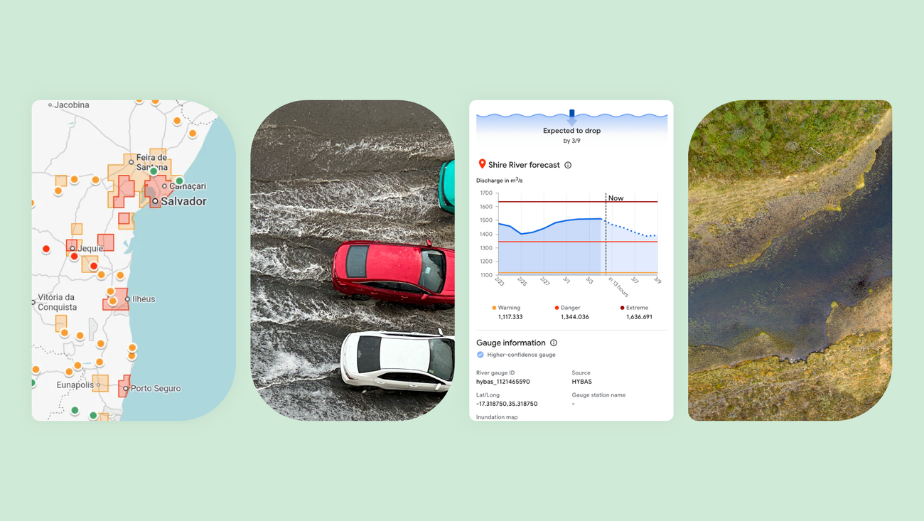
Google has launched Groundsource, an AI-powered methodology that transforms millions of public disaster reports into predictive models for natural disasters. The system's first application focuses on urban flash floods, one of the most dangerous and difficult-to-predict weather events.
Using Gemini to analyze decades of public records, Groundsource identified over 2.6 million historical flood events across more than 150 countries. The system then employed Google Maps to determine precise geographic boundaries for each event, creating what Google describes as the most comprehensive dataset on urban flash flooding to date.
The resulting dataset was used to train a new forecasting model capable of predicting flash floods in urban areas up to 24 hours in advance. These predictions are now live in Google's Flood Hub, significantly expanding the platform's coverage beyond river floods to include sudden urban flooding events that often catch communities off guard.
From Historical Data to Real-Time Predictions
The methodology addresses a critical gap in disaster preparedness. While river flooding can often be predicted days in advance through water level monitoring, urban flash floods occur rapidly when drainage systems are overwhelmed by intense rainfall. Historical data for these events has been fragmented across local reports, news articles, and government records, making systematic analysis nearly impossible until now.
Groundsource synthesizes information from diverse sources, including municipal reports, emergency service logs, and citizen observations. By standardizing this data and mapping it geographically, the system identifies patterns that human analysts would struggle to detect across such large datasets. The 24-hour advance warning window gives residents and emergency services time to prepare, move to higher ground, or implement flood barriers.
Open Source Approach
Google plans to open-source Groundsource to enable partners and researchers to apply the methodology to other disaster types and regions. The decision reflects recognition that many areas most vulnerable to climate-related disasters lack the resources to build comprehensive historical databases on their own.
The open-source release will include the core analysis pipeline and geographic mapping tools, allowing organizations to adapt Groundsource for earthquakes, wildfires, landslides, or other localized disasters. Google emphasized that the system is designed to work even in data-sparse regions, using AI to extract meaningful patterns from limited historical records.
The expansion of Flood Hub to include urban flash floods represents a practical application of large language models beyond text generation. While Google Sheets and other productivity tools have recently gained Gemini features for everyday tasks, Groundsource demonstrates the technology's potential for analyzing unstructured data at scale to address real-world safety challenges.
The urban flash flood forecasts are available now through Flood Hub for select cities, with broader geographic coverage planned throughout 2026 as the system ingests additional historical data and refines its predictions.
Sources
1 checkedHow we cover tool news: Create With's tool desk drafts these reports with AI from the sources listed above and checks them against those sources before publishing.

 Supabase